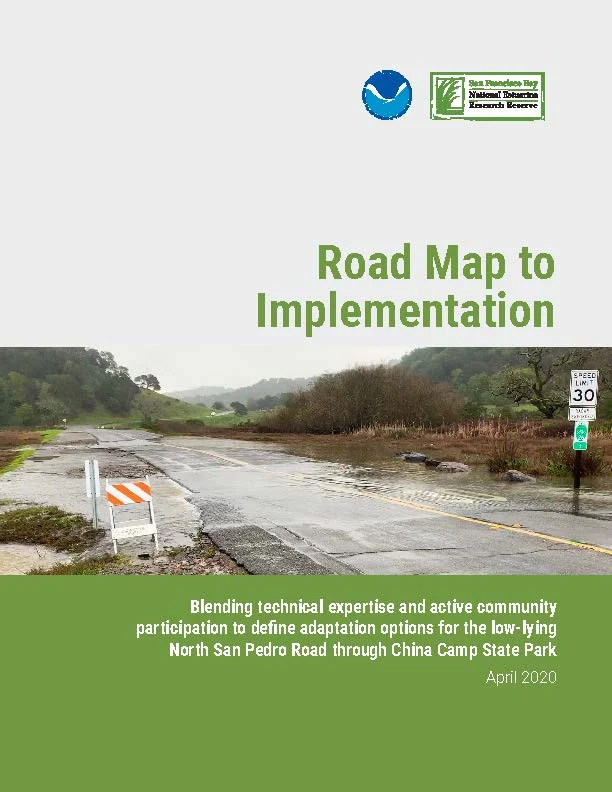
North San Pedro Road runs along the shoreline of China Camp State Park in San Rafael, Marin County, California. The road is an important transportation corridor; however, the shoreline section of the road routinely floods. A community stakeholder process led by San Francisco Bay Reserve and involving Marin County (Public Works, Parks, elected officials), California State Parks, and other stakeholders, evaluated a suite of adaptation options for China Camp State Park.
About this resource
This "road map" report outlines four next steps to implement an adaptation project for North San Pedro Road, including: a feasibility study, planning and design, implementation, and long-term operations and maintenance. The report describes the elements of the feasibility assessment (Step 1) and draft plan (Step 2) for which the next round of funding will be sought, and summarizes the environmental planning and design stage (Step 3) that will follow. A discussion of potential funding sources and regulatory considerations is also included.
Two companion reports give more information about the project: Options and Qualitative Evaluation details the community stakeholder process and its outcomes. Existing Conditions summarizes available data for the project area that informed feasibility assessments of adaptation options.
San Francisco Bay National Estuarine Research Reserve (SF Bay NERR). 2020. Road Map to Implementation: Blending Technical Expertise and Active Community Participation to Define Adaptation Options for the Low Lying North San Pedro Road Through China Camp State Park. San Francisco State University Estuary & Ocean Science Center, Tiburon, CA.