This project mapped estuarine habitats across all 30 National Estuarine Research Reserves, using two different approaches - elevation-based and historical mapping. Participants included staff from all Reserves, technical advisors, and local and national partners, who together gained a more accurate understanding of where estuaries once were and where they could be in the future.
The Project
Estuaries are coastal gems. To protect and restore them, we need a clear understanding of where they are, where they once were, and where they could be in the future. However, current methods of estuary mapping often do not accurately capture the true extent of estuarine wetlands, especially those that are forested. Understanding an estuary’s past extent—an indication of where it could be again—is even more challenging, but important to setting restoration strategies. To better understand both the extent of estuary habitat and the shortcomings of conventional methods for mapping, this project team undertook an ambitious effort to more accurately map estuary habitat in and around the 30 National Estuarine Research Reserves (NERRs).
The project team collaborated with more than 75 local reserve staff, technical advisors, educators, conservation professionals and other partners to bring together local and historical knowledge and produce a more comprehensive picture of estuarine habitat across the NERR System. They used a powerful combination of NOAA resources including tidal and land-elevation data, historical topographic sheets, and mapping from USFWS’s National Wetland Inventory (NWI). The project findings revealed that estuary extent is often significantly greater than currently mapped by USFWS’s National Wetland Inventory (NWI). For more than three-quarters of the 30 Reserves, the project detected tidal forests that were missed by NWI mapping methods. Findings also revealed regional differences in how estuaries have changed over time, underscoring the need for tailored coastal resilience strategies across geographic areas.
Overall, these findings suggest that multiple mapping methods complement each other and together are more accurate than any single approach. Multiple mapping methods should be integrated to provide a more accurate understanding of estuaries—past, present and future. This project has strengthened strategic planning for estuarine habitat conservation and restoration at both national and local scales in the face of sea-level rise and lake-level change. For example, this study revealed:
- More tidal marsh loss on the Pacific coast than other coasts, highlighting the need for investment in restoration in this region.
- Vast amounts of previously unmapped tidal forests at many estuaries on the Gulf and Atlantic coast. These tidal forests merit more conservation attention since they risk turning into ghost forests as a result of sea level rise and salinity increases.
- A significant opportunity for tidal wetland restoration behind a dam at Great Bay in New Hampshire.
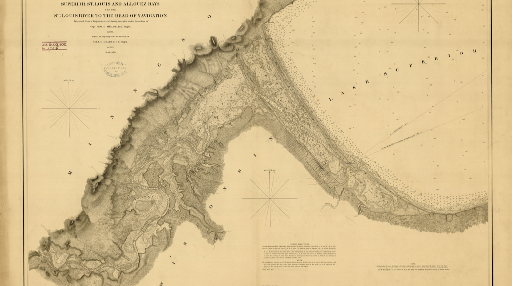
- Locations where manoomin (wild rice) was grown in the past in Lake Superior in Wisconsin and where it could be restored.
The Impact
- Developed new methods and tools to empower NERR and other estuary research programs in their continued efforts to inventory estuarine habitats, in particular with scalable interactive maps showing habitat change over time.
- Through an interactive story map and 30 custom reports, one for each reserve, strengthened capacity for evidence-based local strategic planning efforts that is informed by a more accurate understanding of past and present estuary boundaries.
- Provided key lessons on national patterns of estuarine habitat change, building capacity for more coordinated national strategic planning efforts.
- Expanded community support about the need for, targeting of, and opportunities for estuarine habitat conservation and restoration.
- Provided a model for large-scale NERR collaborations, with involvement and budget for all Reserves, and support from national and local technical and outreach advisors.
Want to Explore More?
Find a comprehensive collection of the project’s products on this NERRA webpage. Explore a guided StoryMap tour of national and Reserve-level results, an interactive web application for data exploration, detailed technical reports for each reserve, recordings of webinars summarizing the project, downloadable data, and more!
Select project products and related links are also featured at the bottom of this page.