Building on previous and ongoing work at China Camp State Park, this project provided field data, vulnerability assessments and community engagement to advance toward selecting adaptation strategies to protect and enhance natural resources and archaeological and tribal cultural resources while accommodating ongoing utilization of an important shoreline road subject to regular coastal and storm flooding.
China Camp State Park is one of the few remaining ecologically intact bay-wetland-upland landscapes of the San Francisco Estuary. These landscapes historically and today have been used by and remain important to the local Coast Miwok and Southern Pomo groups, represented today by the Federated Indians of Graton Rancheria (FIGR), a federally recognized tribe.
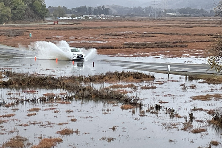
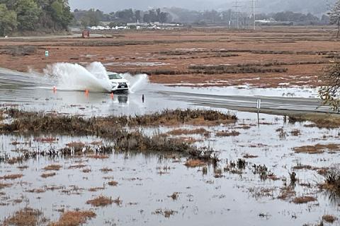
Since the 1890s, the North San Pedro Road has traversed China Camp to provide critical transportation needs. The road serves as the sole vehicle access to the State Park and all its recreational, educational, scientific, and cultural uses and natural resources. It also serves as a critical evacuation and emergency services route as well as a commuter corridor.
However, low-lying sections of this road are prone to frequent and severe king tide and storm flooding, impacting this important transportation corridor. The road also restricts tidal exchange with the interior marshes, impacting marsh ecology and impeding capacity for marsh migration into the adjacent alluvial meadows. Road modification is necessary for the community to maintain road access to and through the park as sea level rise continues to threaten low-lying roads and for remedying the impaired marsh ecology and resiliency. With rising sea levels and increased intensities of storm events, this flooding will increase in frequency and severity.
Through a previously awarded 2019 Catalyst Grant, stakeholders including California State Parks, the San Francisco Bay NERR, Federated Indians of Graton Rancheria (FIGR), the Friends of China Camp, neighborhood groups, and Marin County local officials reached consensus to pursue a sea level rise road modification project that allows for long-term transportation needs, marsh resilience, recreational and educational use, and archaeological and tribal resource protection.
Building on these earlier efforts, this Collaborative Research project focused on documenting vulnerable archaeological and tribal cultural resources, projecting how they may be affected with climate change, filling in key geophysical knowledge gaps for selecting and advancing adaptation options including marsh connectivity specific to watershed-bayland interactions, and continuing with the community-led planning process and associated outreach activities.
This work is supplemented by two related efforts: SF Bay NERR funds under the Bipartisan Infrastructure Law to install long-term elevation monitoring infrastructure, conduct subsurface geoarchaeological borings to assess whether road construction work has potential to encounter archaeological resources, and jurisdictional delineation to support the state and federal regulatory process. The Marin County Board of Supervisors approved funds to hire an engineering consultant to develop road redesign options to a concept level and assess their construction considerations and estimated costs.
The project has helped identify viable near-term adaptation solutions to protect cultural resources, while more longer term solutions are developed and pursued. In addition, data collected during the project has helped set the baseline for assessing efficacy of the future adaptation actions.
Project Lead Stuart Siegel (San Francisco Bay National Estuarine Research Reserve) gives a short introduction to "Respecting the Past, Planning for the Future: Assessing Cultural Resources and Watershed Connectivity Associated with a Road Modification Project" a collaborative research project funded in 2021 by the NERRS Science Collaborative.