From 2010-2014, the Dauphin Island Sea Lab and the Grand Bay National Estuarine Research Reserve conducted a large-scale, multidisciplinary collaborative project funded by the NERRS Science Collaborative on the Mississippi/Alabama coast. The project improved understanding of the legacy effects of human land-use change on water quality, fisheries resources, and human health in the region. At the culminating workshop, more than 40 stakeholders from local, state and federal agencies and members of the public identified three products of greatest value to end users that could be developed from the project team's research data. These products included: informational packets for ecotour operators and municipal authorities to enhance awareness and education; a webpage to provide the public and management authorities with centralized resources and recommendations to improve water quality; and simple predictive models to demonstrate how changes in land use affect water quality. To create these products, the Dauphin Island Sea Lab and Grand Bay Reserve collaborated on a 2017 Science Transfer project.
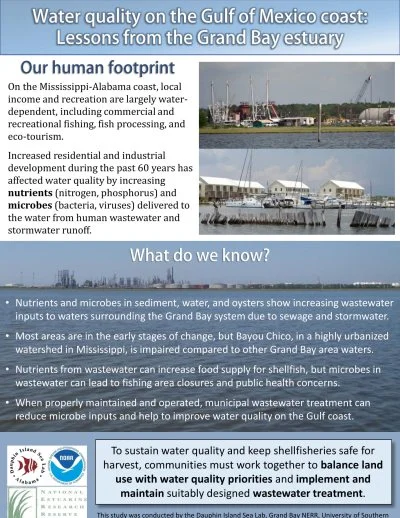
One output the project team developed is this "edutainment" packet, which helps end users share information about water quality on the Mississippi-Alabama coast. The packet contains a factsheet tool which outlines threats to water quality in the Grand Bay system and describes sources of nutrients and microbes in detail. It also gives readers helpful information about ways they can improve local water quality. To measure the impact of the tool, the project team also included a survey for end users to share their feedback about the factsheet's utility.