Northeastern Florida and the Guana Tolomato Matanzas NERR have some of the most intact estuarine ecosystems in the southeastern United States; however, some areas are expected to need targeted management to stabilize land, protect habitat, and maintain surface elevation relative to sea level rise. To promote coastal wetland resilience, the GTM NERR land managers are prioritizing surface elevation and exploring proactive techniques for wetland restoration. This project leveraged a larger National Science Foundation funded project WETFEET and explored the effectiveness of four coastal elevation management options: (1) thin-layer sediment deposition, (2) berm redistribution, (3) living shorelines, and (4) facilitation of mangrove encroachment.
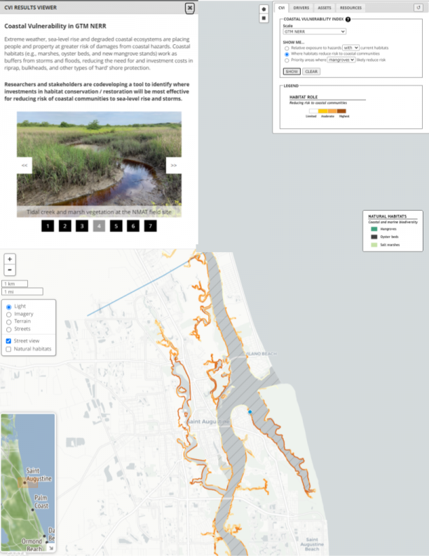
The team used remote sensing and field data to develop a coastal vulnerability index assessment map for GTMNERR managers and brought together regional scientists and land managers in two workshops to explore the effectiveness of coastal elevation management options and plan for targeting wetland restoration pilot projects. This viewer was developed to disseminate results of the Coastal Vulnerability Index and to inform site selection for restoration projects.