About the Project
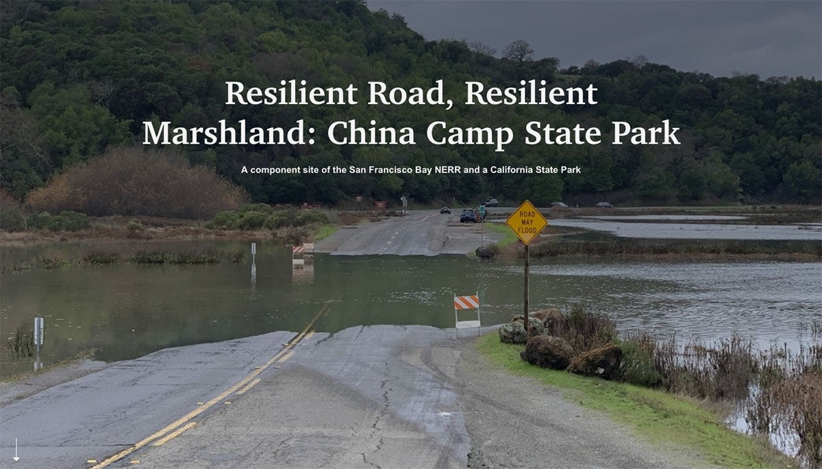
China Camp State Park is one of the few remaining ecologically intact bay-wetland-upland landscapes of the San Francisco Estuary. These landscapes historically and today have been used by and remain important to local tribes. China Camp has a long and highly valued cultural significance for the Coast Miwok and Southern Pomo groups, represented today by the federally recognized Federated Indians of Graton Rancheria (FIGR). North San Pedro Road provides key access to China Camp State Park. However, low-lying sections of this road are prone to frequent and severe king tide and storm flooding, impacting this important transportation corridor. The road also restricts tidal exchange with the interior marshes, impacting marsh ecology and impeding capacity for marsh migration into the adjacent alluvial meadows. Road modification is necessary for the community to maintain road access to and through the park as sea level rise continues to threaten low-lying roads and for remedying the impaired marsh ecology and resiliency.
This Collaborative Research project advanced adaptation planning at China Camp State Park through several avenues: assessing vulnerable archaeological and tribal cultural resources, projecting how they may be affected with climate change, filling in key geophysical knowledge gaps for selecting and advancing adaptation options including marsh connectivity specific to watershed-bayland interactions, and continuing the ongoing community-supported planning effort. Community engagement draws in a wide range of users, including Park users, neighborhood groups, local emergency services, elected officials, conservation and research organizations, state and federal regulatory and resource agencies, and tribal representatives.
About the Resource
This story map describes the challenges facing the low-lying roadway through China Camp State Park from storms, king tides, and rising sea levels, the resources the road impairs, the history of the park and what makes ongoing access so important to the region and to the Coast Miwok, the approach the SF Bay NERR has led to develop bottom-up community based adaptation solutions, possible adaptation options, and how the community can engage.
The story map is intended for use by the broader user community, including local residents, local government, elected officials, conservation organizations, recreation and education interests, and the state and federal regulatory and resource agencies.
.