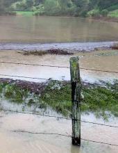
Increasingly, coastal communities facing sea level rise must find solutions to routine flooding of low-lying roads and other infrastructure. A project led by the San Francisco Bay National Estuarine Research Reserve took a close look at one example of this complex problem—a Marin County shoreline road that serves as an important transportation corridor between north and south San Rafael, CA.
About this resource
This video illustrates a flooding event that affected a shoreline section of North San Pedro Road in northern California. In this case, a large rain storm and run-off from the watershed could not drain through undersized culverts and led to road flooding. (The road also floods during winter king tides that raise water levels in San Francisco Bay.) This video is the first part of a two-part series: see Part 2.