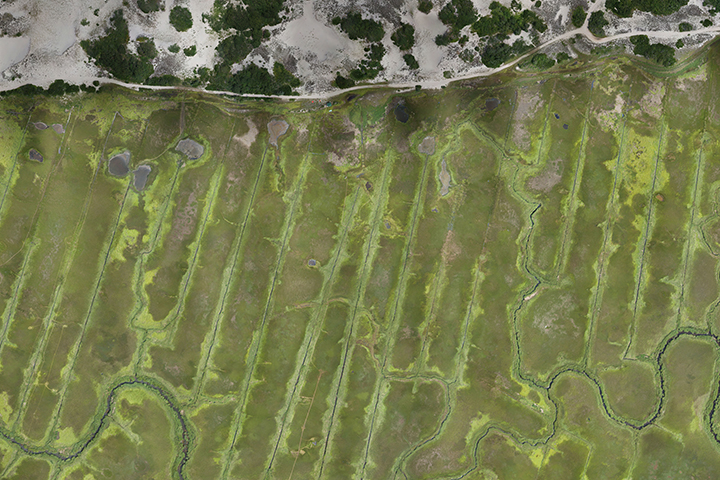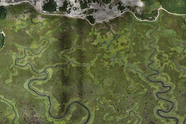
Parallel grid ditches were dug in approximately 90% of mid-Atlantic and New England salt marshes in the 1920s through the 1940s. Today, managers must navigate the effects of past actions when making decisions about marsh hydrology and drainage that impact human health, ecosystem services, and marsh sustainability. Managers must also consider how stressors such as sea-level rise impact marshes. Consequently, managers are faced with highly localized and complex scenarios that force them to make tradeoff decisions. Management decisions are often made in response to an on-the-ground problem, and the implications are learned later. This trial-and-error approach can consume time and budgets. As rising sea levels pose increasing challenges to coastal marshes, it is vital that managers have science-based tools that can help them identify best strategies, optimize critical ecosystem services, and save time and resources.
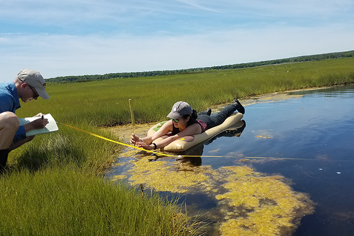
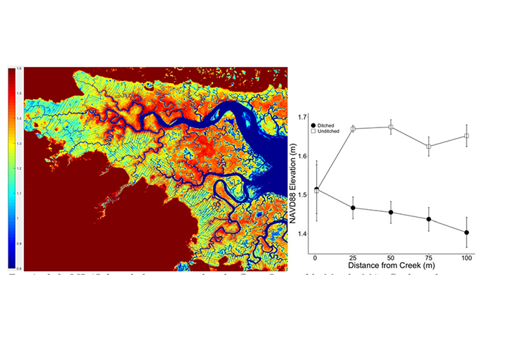
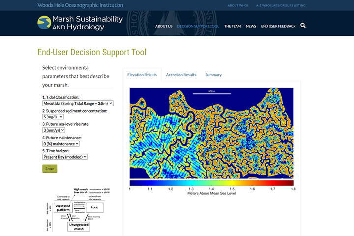
Coastal managers and restoration practitioners from Waquoit Bay National Estuarine Research Reserve in Massachusetts and partner local, state, and federal agencies and nonprofit organizations expressed a need to understand the tradeoffs of hydrologic management strategies (i.e., ditch remediation, density, maintenance) and identify actions that will achieve user-specified outcomes— such as drainage, maintaining elevation, and carbon burial. In this project, a team of scientists, including reserve staff, responded to that need by working iteratively with end user groups to develop a decision support tool for marsh hydrology management strategies that promote sustainability and delivery of valuable ecosystem services under future sea level scenarios. The tool predicts potential outcomes of ditch and runnel maintenance in micro- and macro-tidal salt marshes under different scenarios of suspended sediment input and sea level rise. Outputs include elevation, vertical accretion rates, and habitat distribution along creekbank edges and in the marsh interior. The tool is based on a two-dimensional model (Marsh2D) and informed by field data collected on Cape Cod, Massachusetts.