About the Project
Tidal marshes are facing tremendous pressures from accelerating rates of sea-level-rise. As sea level is rising, marshes are changing. This project was the first in-depth study to leverage a nationally-coordinated dataset generated by 20 National Estuarine Research Reserves across 85 marshes in 17 states to better understand how sea level rise is affecting tidal plant communities. The National Marsh Synthesis Team (NAMASTE) enacted a data synthesis framework that included in-depth conversations with all participating reserves to integrate local datasets into a standardized national dataframe. This dataframe was analyzed to quantify vegetation change across marsh characteristics at local, regional and national scales. The project produced site to national level trends, a data tool package aiding in analyzing tidal marsh data (e.g, data templates, coding script, coding user guides and training videos, data visualization apps, a GIS dashboard), and communication tools (e.g., illustrations, logo, website). As the NERR system continues to collect tidal marsh data, these tools can be used by reserve staff or collaborators to include newly collected data.
About the Resource
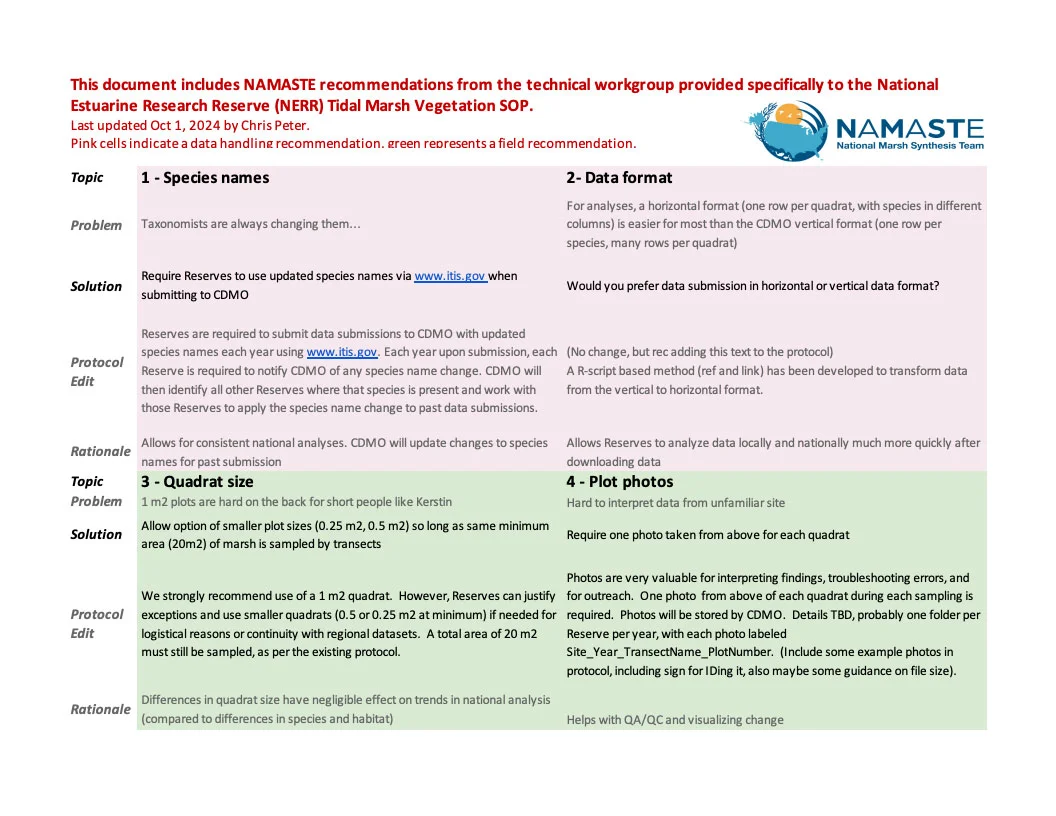
The NERR system uses a common protocol to conduct long-term estuarine marsh monitoring of vegetation communities. This protocol helps reserves to standardize monitoring approaches and collect similar types of data. As the system and its data holdings have grown, new challenges associated with cross-reserve comparison of marsh vegetation data have emerged.
This resource provides recommendations for improving the NERR system’s Estuarine Marsh Vegetation Monitoring Protocol to improve data unification across the national system, and the ability to perform future national syntheses. Through system-wide collaboration, many of these recommendations have been incorporated into the latest version of the NERR Estuarine marsh monitoring SOP.