About the project
A 2016 - 2020 collaborative research project assessed the value of Piermont Marsh in protecting coastal communities from storm surge and flooding amid a changing climate. The study focuses on Piermont Marsh, a 200-acre brackish tidal wetland located 15 miles upriver from New York City, adjacent to the Village of Piermont. The Village of Piermont is at risk now and in the future of flooding resulting from both winter nor ’easters and summer and fall tropical cyclones.
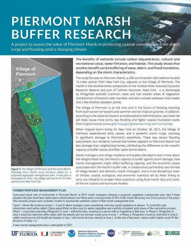
Marsh managers and village residents and leaders decided to learn more about the village ’s flood risk, the marsh ’s capacity to buffer against storm damage, how marsh management might affect buffering capacity, and the economic values associated with the marsh ’s buffer role. A collaborative partnership was formed of village leaders and advisors, marsh managers, and a multi-disciplinary team of climate, coastal, ecological, and economic scientists led by Peter Sheng to carry out research to answer these questions using local marsh data and state of- the-art coastal and hurricane models.
About this resource
This four-page outreach tool summarizes project findings for marsh managers and leaders and residents of Piermont Village. Using graphics and photos, the document outlines the project approach and key takeaways for future resiliency planning.