About the Project
Tidal marshes are facing tremendous pressures from accelerating rates of sea-level-rise. As sea level is rising, marshes are changing. This project was the first in-depth study to leverage a nationally-coordinated dataset generated by 20 National Estuarine Research Reserves across 85 marshes in 17 states to better understand how sea level rise is affecting tidal plant communities. The National Marsh Synthesis Team (NAMASTE) enacted a data synthesis framework that included in-depth conversations with all participating reserves to integrate local datasets into a standardized national dataframe. This dataframe was analyzed to quantify vegetation change across marsh characteristics at local, regional and national scales. The project produced site to national level trends, a data tool package aiding in analyzing tidal marsh data (e.g, data templates, coding script, coding user guides and training videos, data visualization apps, a GIS dashboard), and communication tools (e.g., illustrations, logo, website). As the NERR system continues to collect tidal marsh data, these tools can be used by reserve staff or collaborators to include newly collected data.
About the Resource
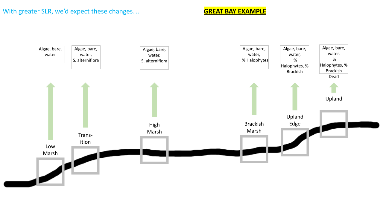
The Ecotone Migration Index (EMI) is a new biotic index created by NAMASTE to convey the impact of sea level rise across marsh zones. EMI is the proportional cover of species/covers or species/cover groupings that are expected to increase within a vegetation zone as sea level rises. Traditional metrics (e.g., individual species cover, species richness, total live cover), are often difficult to compare across regions and/or don’t incorporate effects seen across vegetative zones. However, EMI is a customizable ratio of Reserve-identified positive indicator covers of sea level rise (SLR) (biotic or abiotic) to total cover, where indicator covers are selected by zone or ‘ecotone’ for each Reserve.

Originally deriving from the S. alterniflora/S. patens ratio (Burdick et al., 2020), the EMI allows a targeted analysis of plant communities response to sea-level-rise by taking into account the anticipated effect of each plant species or groupings (e.g., halophytes) across specific vegetation zones unique to each bioregion, and quantifying the cumulative community response. For example, this novel metric is able to convey how an increase in Spartina alterniflora in the high marsh (positive EMI) may be in response to SLR, while an increase in bare ground (replacing S. alterniflora) in the low marsh would also indicate an increase EMI.
The index is standardized on a 0 to 1 scale, facilitating easier comparison across sites, where 1 indicates the greatest plant community response to sea-level-rise. The NAMASTE project used EMI as a metric of comparison for marshes across the country and found that EMI increased at a greater rate in the Northeast and Gulf of Mexico compared to other regions, signifying that vegetation covers indicative of SLR were observed more frequently across their vegetation zones than the Southeast, West, or Mid-Atlantic.
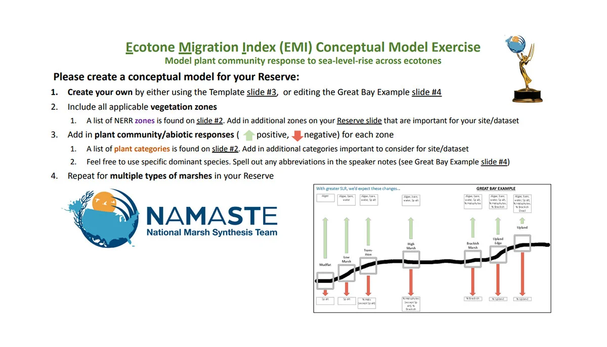
Ecotone Migration Index (EMI) Conceptual Model Exercise
The slide decks below can be used to create a conceptual model of plant community response to sea-level-rise (SLR) across vegetation zones in your bioregion by selecting indicator covers for each vegetation zone. Once indicator species are selected, you can compare their combined percent cover to the total cover of vegetation plots and calculate an EMI score.
Example of the Ecotone Migration Index (EMI) Conceptual Model customized with information from Great Bay NERR: