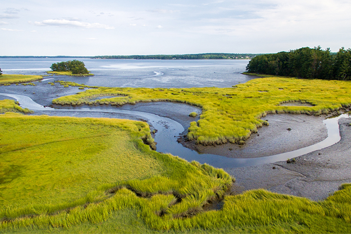
This project transferred conservation science from the 2021 New Hampshire Coastal Watershed Conservation Plan to help protect and restore estuarine systems in the Piscataqua watershed region using an ecosystem services approach.
The project
Since 2006, the landscape-scale Land Conservation Plan for New Hampshire’s Coastal Watershed has informed watershed protection goals, identified regional priorities, and guided strategic decision-making. Working collaboratively with landowners and municipalities, public and nonprofit conservation organizations have protected over 82,000 acres in New Hampshire’s 42-town coastal watershed through the Great Bay Resource Protection Partnership (GBRPP) – a regional partnership formed in 1994 that includes land trusts and federal and state agencies. However, the Seacoast Region continues to experience intense development pressure and more frequent and intense coastal and inland flooding due to climate change.
In the summer of 2018, the Great Bay Reserve received NERRS Science Collaborative capacity building funds to assess the need for outreach related to the 2006 Land Conservation Plan and goals for that outreach. Following that project, the New Hampshire Chapter of The Nature Conservancy secured funding in 2019 and 2020 to complete the GIS analysis needed to update the 2006 Land Conservation Plan, guided by the goals established during the capacity grant. The revised 2021 New Hampshire Coastal Watershed Conservation Plan (2021 Plan) reflects updated conservation priorities for climate adaptation, water resource protection, wildlife habitat and landscape connectivity corridors, and working lands.
This project facilitated the transfer of knowledge from the updated plan to intended users in the region through a focused outreach effort, which included a needs assessment, formal knowledge transfer workshops, and a technical assistance program. The team created a website that provides a landing page for all of the information related to the 2021 Plan. Other products include: a set of sub-watershed and community maps to highlight conservation focus areas, agricultural resource areas, and existing public lands; a two-page fact sheet providing an at-a-glance overview of the 2021 Plan; a two-page fact sheet summarizing the need for land-protection funding in policy discussions; and a set of instructions for accessing the 2021 Plan data layers on the New Hampshire Coastal Viewer online mapping tool.
The impact
- The inclusion of the 2021 Plan as a focus area metric in the Piscataqua Region Estuaries Partnership’s 2023 State of Our Estuaries report affirmed it as the primary conservation planning tool driving targeted land conservation across the coastal watershed. Outreach efforts to municipal staff, boards, and commissions resulted in science transfer for informed land use decision making.
- Feedback received from post-webinar surveys indicates an increase in understanding of the science behind the 2021 plan. 100% of evaluation respondents reported gaining knowledge about the 2021 NH Coastal Watershed Conservation Plan; 93% learned about ways the Plan can be used; and 85% feel motivated to use the Plan in their work/community.
- Project team members, with input from key intended users from the Great Bay Resource Protection Partnership and the project’s Advisory Committee, produced a project sustainability plan to support continued partnerships and carry forward the project products. Soliciting input and collaborating on the sustainability plan with these groups helped build shared priorities that match their interests and needs into the foreseeable future. The sustainability plan offers a template to carry project outputs and outcomes forward beyond the grant term, and provides an example of long-term planning for post-project activities.