As communities in Alaska ’s Kenai Lowlands prepare for a changing climate, information about groundwater is essential to manage the watershed for both people and salmon.
To better understand the availability of groundwater and how human activities impact this resource, a collaborative research project led by the Kachemak Bay National Estuarine Research Reserve and University of South Florida built a model that shows the depth and extent of aquifers and predicts groundwater discharge and recharge. The project team joined this new science with local expertise to interpret the groundwater model for use in land use planning, permitting, policy decisions, and habitat protection. The project developed a suite of tools and trainings to help stakeholders better understand groundwater dynamics.
About this resource
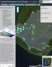
As part of this project, the team developed an Esri story map that provides a self-guided, multimedia overview of groundwater, people, and salmon intersections. A Story of Groundwater for the Protection of Salmon in the Kenai Lowlands describes the importance of groundwater for salmon throughout its lifecycle. It also discusses a project to develop a groundwater prediction tool for the Kenai Lowlands and shows how this tool can be used to understand the intersection between groundwater availability for salmon streams and human use of groundwater resources.
NOAA EPP, KBNERR, USF. 2019. A story of groundwater for the protection of salmon in the Kenai Lowlands